
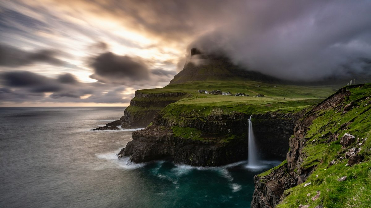
Start with this itinerary
Open this Faroe Islands itinerary in Honge as your starting point, then shape the pace around weather, village walks and a few cliff-edge viewpoints.
How Many Days in the Faroe Islands Is Enough?
Seven days is enough for a Faroe Islands road-trip loop: Vágar for Sørvágsvatn and Gásadalur, Tórshavn and northern Streymoy, then Funningur and Gjógv on Eysturoy. Skip Mykines, Kalsoy and Suðuroy in this window; add them if you have 10 days.
Keep the structure tight: Vágar first for the airport and cliff walks, Tórshavn as the Streymoy base, then Eysturoy with a spare weather day. Trying to add Mykines, Kalsoy and Suðuroy into the same seven days usually turns ferry weather into the main risk.
The strongest version is this one: Gásadalur and Sørvágsvatn on Vágar, Tórshavn plus Saksun and Tjørnuvík, then Funningur and Gjógv before a buffer return toward the airport. Use the extension ideas below if you can stay longer.
Introduction
There are destinations that make you feel as though you have travelled to the edge of the world. The Faroe Islands are one of them. Rising from the North Atlantic between Iceland and Norway, this remote archipelago is a landscape of towering cliffs, rolling green mountains, waterfalls dropping into the sea, and tiny villages tucked into narrow coastal valleys.
A seven-day road trip is an opportunity to see that landscape at a slower pace. Begin on Vágar, where Sørvágsvatn appears to hover above the Atlantic and the waterfall at Gásadalur plunges towards the ocean. Continue to Streymoy for the colourful streets of Tórshavn, the isolated village of Saksun and the beach at Tjørnuvík. Then cross to Eysturoy, where Funningur and Gjógv sit beneath steep mountain slopes and fjord-like inlets.
This is not a destination where every day should follow a rigid schedule. Weather can change within hours. A clear morning may turn into mist, strong winds or heavy rain by afternoon, and a mountain viewpoint can disappear behind cloud just as you arrive. That unpredictability is part of the experience, and it makes flexibility essential.
Visit the islands in a logical geographical order, keep outdoor plans adaptable, and leave the final day open.
Why This Trip Works
- A compact first loop: two nights on Vágar cover the airport, Sørvágsvatn and Gásadalur; Tórshavn then opens Streymoy; Eysturoy finishes the week without chasing every island.
- Weather has a spare day: Day 7 is left open so fog or wind on an earlier hike does not collapse the whole plan.
- Driving is the point, not a chore: distances are short, but tunnels, mountain passes and passing places reward a slower speed.
- Villages, not a city-led checklist: Tórshavn is the one cultural pause; the rest of the week is coastline, waterfalls and small settlements.
Who Is This Trip For?
This journey suits travellers who enjoy dramatic natural scenery, remote villages and outdoor exploration. It works well for first-time visitors who want a practical road-trip introduction rather than an attempt to see all 18 islands.
Couples, solo travellers and friends who are comfortable with changing weather, narrow roads and some hiking will get the most from the week. It is less ideal if you prefer guaranteed sunshine, nightlife or a packed daily schedule.
Good to Know
- Currency: Danish krone (DKK). Cards work widely in Tórshavn; smaller villages have fewer services.
- Language: Faroese and Danish. English is commonly understood in visitor-facing businesses.
- Time zone: Western European Time / Western European Summer Time.
- Driving: cars drive on the right-hand side. Sheep may be on or beside the road.
- Entry: the islands are part of the Kingdom of Denmark but are not in the Schengen Area. Check passport rules for the Faroes specifically.
- Tunnels: Vágatunnilin and Eysturoyartunnilin have tolls. Confirm how your rental company handles payment.
Before You Go
- Book the rental car and Vágar or Tórshavn accommodation early for June–August.
- Read current hiking-fee and Sørvágsvatn trail arrangements before locking Day 2.
- Confirm undersea-tunnel tolls with the rental desk at the airport.
- Check weather and road conditions each morning.
- Review entry requirements and travel advice for your nationality, including the Faroe Islands note on the Denmark page.
Journey Overview
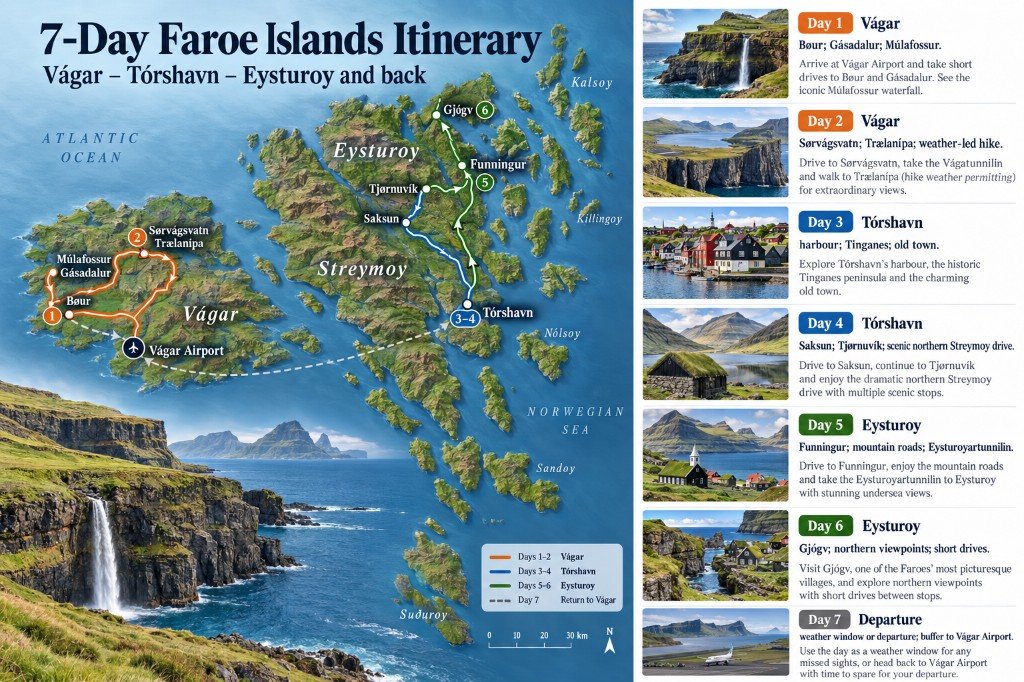
The route starts at Vágar Airport, crosses under the sea to Streymoy for the capital and the northern coast, then continues to Eysturoy before returning towards the airport.
| Day | Base | Focus | Travel / getting around |
|---|---|---|---|
| Day 1 | Vágar | Bøur, Gásadalur and Múlafossur | Airport, then short drives |
| Day 2 | Vágar | Sørvágsvatn and Trælanípa | Hike; weather-led |
| Day 3 | Tórshavn | Harbour, Tinganes and the old town | Vágatunnilin, then walk |
| Day 4 | Tórshavn | Saksun and Tjørnuvík | Scenic northern Streymoy drive |
| Day 5 | Eysturoy | Funningur and mountain roads | Eysturoyartunnilin |
| Day 6 | Eysturoy | Gjógv and northern viewpoints | Short drives; optional views |
| Day 7 | — | Weather window or departure | Buffer to Vágar Airport |
Route Map
Day 1 — Arrival on Vágar and the Village of Bøur
The week begins at Vágar Airport, the archipelago’s main international airport. After collecting your rental car, take time to settle into the local driving environment before setting off. Roads are generally well maintained, but they can be narrow, winding and exposed to changing weather.
Begin with Bøur, a small settlement overlooking the Atlantic. Traditional houses, green hills and views towards the sea stacks of Tindhólmur give an immediate introduction to the islands’ landscape. Stay on public paths and avoid private property.
Continue towards Gásadalur, once relatively isolated by its mountain setting and now reached through a tunnel. The village is known for Múlafossur Waterfall, where water drops from a grassy cliff towards the ocean.
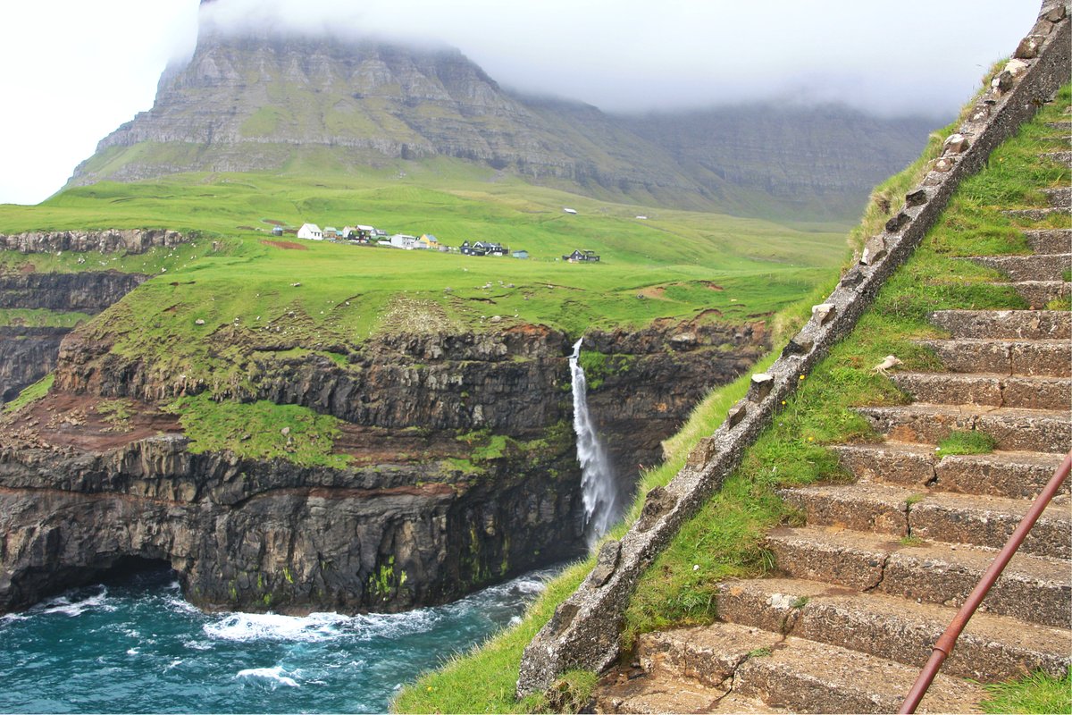
Stay if conditions allow, but avoid exposed edges and follow local access guidance. Return to your accommodation on Vágar for a quiet evening rather than adding more stops.
Food note: try a local café or guesthouse meal if it is open, and look for Faroese fish dishes. Dining options in smaller villages are limited, so check opening arrangements ahead.
Do not miss: Bøur’s coastal views, Gásadalur and Múlafossur.
Logistics: stay on Vágar for the first two nights. That reduces driving after arrival and keeps you close to the main hike.
Day 2 — Sørvágsvatn and the Atlantic Cliffs
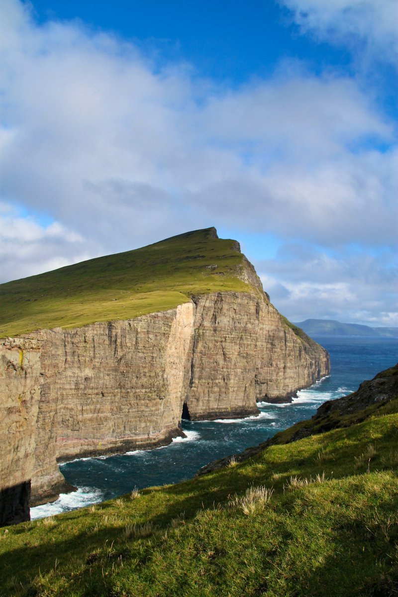
Today is for one of the archipelago’s most famous landscapes: Sørvágsvatn, also known as Leitisvatn. The lake sits above the Atlantic, creating the visual impression that it floats high above the sea.
Begin early in the busier summer months. Follow the designated trail and local access rules, including the hiking fee and check-in at the landowners’ reception by the main gate. Details change; confirm them on the trail site and Visit Faroe Islands’ hiking-fee page.
The walk is commonly treated as a moderate outing, but difficulty depends on wind, rain, visibility and ground conditions. Allow several hours for the return hike and time at the viewpoints. Waterproof layers, suitable footwear, water and snacks are essential.
The Trælanípa viewpoint gives the dramatic perspective over lake and ocean. Continue only where it is permitted and safe, and do not approach cliff edges for photographs. If the weather deteriorates, shorten the outing or replace it with a lower-level coastal visit.
Spend the afternoon exploring more of Vágar at a relaxed pace, or simply return to your base if you are wet and cold.
Food note: pack a simple lunch and water. A warm meal afterwards is especially welcome if the weather is wet.
Do not miss: Sørvágsvatn, Trælanípa and the Atlantic coastline — if conditions allow.
Logistics: keep enough daylight for the return walk and the short drive back. Do not force the hike simply because it is on the itinerary.
Day 3 — Tórshavn and the Faroese Capital
Leave Vágar and drive towards Tórshavn, the small but characterful capital. The journey uses the Vágatunnilin undersea tunnel. Confirm toll arrangements with your rental provider before you leave the airport desk.
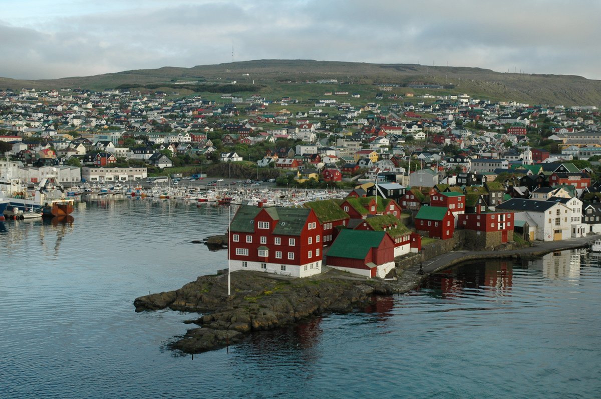
Begin in the harbour area, where fishing boats, waterfront buildings and cafés create a relaxed maritime atmosphere. Continue to Tinganes, the historic district known for its red wooden buildings and grass-covered roofs.
Walk the old town, browse local shops, and visit a museum or cultural stop if the weather is unsettled. Tórshavn is also a useful place to learn more about Faroese traditions, language and the importance of fishing to the local economy. The capital is compact enough to explore on foot, which makes it a good pause between outdoor days.
Food note: look for Faroese lamb, fresh fish and locally inspired menus. Traditional fermented foods are part of the islands’ culinary heritage; flavours can be strong and distinctive.
Do not miss: Tinganes, the harbour, the old town and a café stop.
Logistics: stay in Tórshavn for the next two nights. It is the most practical base for northern Streymoy and has a wider choice of rooms and restaurants than smaller villages.
Day 4 — Saksun, Tjørnuvík and the Northern Coast
Leave Tórshavn for Saksun, a tiny village set in a natural amphitheatre of mountains. It is known for turf-roofed houses and a tidal lagoon that sits between green slopes, dark water and rugged cliffs.
Be mindful of private land, access restrictions and changing tidal conditions. Use only permitted walking routes and check local guidance before entering any restricted area.
Continue north to Tjørnuvík, tucked between steep mountains and a black-sand beach. The drive itself is part of the day: narrow roads, waterfalls and sudden views around bends.
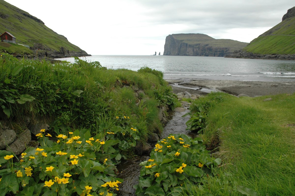
Look out towards Risin and Kellingin when visibility allows. The North Atlantic here is powerful and cold. Keep a safe distance from the water and avoid exposed shoreline in rough conditions. Return to Tórshavn without a strict timetable, leaving room for photo stops in designated pull-ins rather than on the carriageway.
Food note: carry snacks and water. Eat dinner back in Tórshavn.
Do not miss: Saksun’s setting, Tjørnuvík beach and the northern Streymoy drive.
Logistics: allow extra time for passing places, weather delays and photography. Do not stop on blind bends.
Day 5 — Funningur and the Mountain Roads of Eysturoy
Cross from Streymoy to Eysturoy through the Eysturoyartunnilin, an undersea tunnel with a roundabout beneath the sea. Check toll and rental-car payment arrangements before travelling.
Begin with Funningur, a small village beside a sheltered inlet under steep slopes. Houses cluster close to the water, and the surrounding landscape dominates the view.
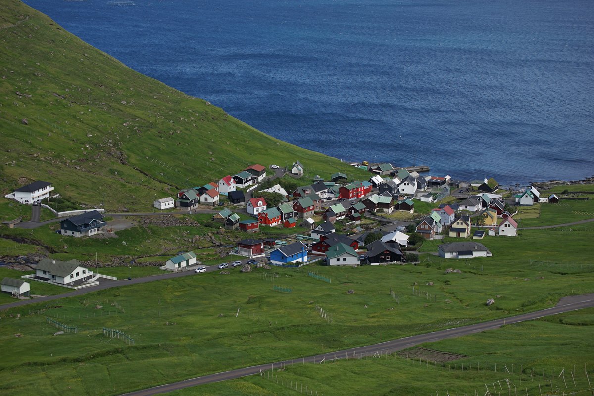
Take a gentle walk through the village, respecting homes and private spaces. Continue along the island’s scenic roads, stopping at safe viewpoints when visibility is good. Strong crosswinds, fog and rain can make exposed stretches demanding. If conditions are clear and you are comfortable with the terrain, add a short walk chosen from current trail information rather than from distance alone.
Staying on Eysturoy makes the next day’s visit to Gjógv more relaxed. Remaining in Tórshavn is fine if you prefer fewer accommodation changes.
Food note: look for local lamb, fish and seasonal dishes. Small settlements may have limited restaurant hours, so plan dinner in advance.
Do not miss: Funningur and the scenic drives across Eysturoy.
Logistics: use designated passing places. Keep fuel and driving time in mind before heading to remoter roads.
Day 6 — Gjógv and Northern Island Views
Begin in Gjógv, one of the most picturesque villages in the islands. The settlement is named after its natural sea-filled gorge, which forms a sheltered harbour between steep coastal rocks.
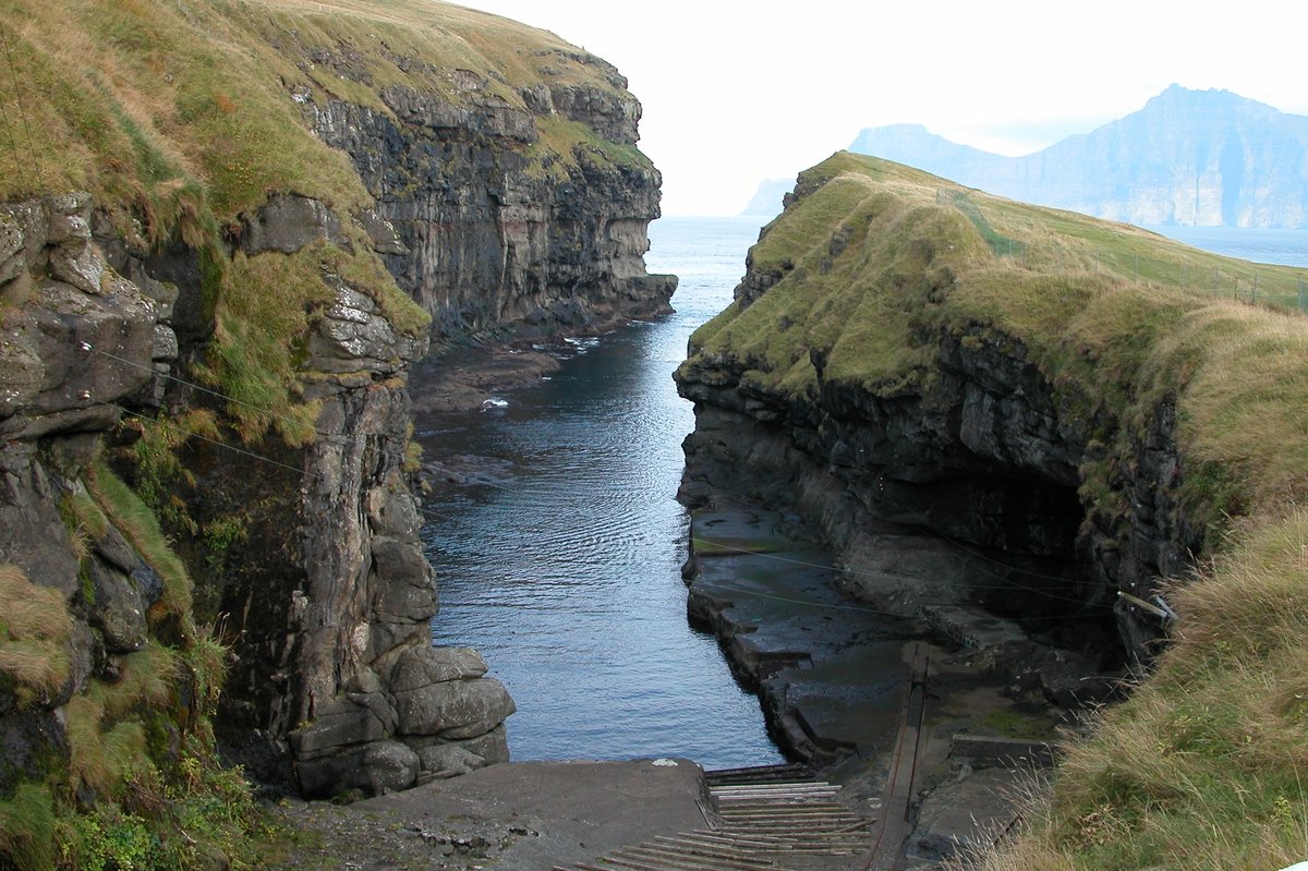
Walk through the village and towards the gorge viewpoint, taking in the houses, green slopes and open Atlantic. If the weather is clear, use the rest of the day for a scenic drive towards selected northern viewpoints on Eysturoy. Avoid trying to cover too many islands in a single day. Weather can add unexpected delays, and the Faroe Islands are better with time to pause.
Keep tomorrow open rather than scheduling a demanding hike or a distant excursion that could be disrupted by departure logistics.
Food note: a warm dinner of Faroese seafood or lamb, if available, is a welcome end to a day outdoors.
Do not miss: Gjógv’s gorge, village lanes and mountain-to-sea viewpoints.
Logistics: check road conditions and visibility before setting out. If you add a different island, confirm tunnel access, tolls and any ferry timetable well in advance.
Day 7 — A Slow Morning or Departure
The final day is intentionally left open. In the Faroe Islands this is one of the smarter parts of the itinerary. If earlier days were affected by fog or rain, use a clear window to revisit a favourite viewpoint or complete a shorter walk.
If conditions are poor, enjoy a slower morning in Tórshavn, visit a museum, browse local shops or sit in a café before departure. If you are already on Vágar, a final coastal stop may fit, provided it leaves a generous buffer for the airport.
Avoid a long hike or remote island excursion close to your flight. Weather, road conditions and tunnel traffic can change.
Food note: a final Faroese breakfast or coffee before the airport is enough.
Do not miss: a relaxed last hour, rather than a rushed extra attraction.
Logistics: confirm the flight, rental-car return and transfer timing the evening before.
Where to Stay
For the first two nights, staying on Vágar is convenient for the airport, Sørvágsvatn, Bøur and Gásadalur. Rooms are more limited than in the capital, so book ahead in summer.
Tórshavn is the practical base for Days 3 and 4. It has the widest selection of hotels, guesthouses, restaurants and shops, and it sits well for day trips around Streymoy.
For Days 5 and 6, consider Eysturoy if you want less daily driving and a quieter setting. Tórshavn can remain your base if you prefer fewer hotel changes. Suggested stay areas in this article are samples only, not named properties.
Getting Around: Car, Tunnels and Ferries
A rental car is the most flexible way to follow this route. It lets you stop at viewpoints, adjust plans around weather and reach villages that are less convenient by bus.
The road network includes bridges, mountain roads and undersea tunnels. Some tunnels are narrow or single-lane, with passing places and specific rules. Follow local signs and drive slowly when visibility is limited.
Several tunnels have tolls. Payment may be handled through the rental company or Tunnil’s registration system. Confirm the arrangement before collecting the car.
Ferries matter if you add islands beyond this loop. Timetables vary by season and weather, and vehicle reservations may be needed. Check SSL before building a day around a crossing. This seven-day sequence can be completed largely by road.
Reduce speed in rain, fog and strong wind. Use headlights as required, watch for sheep, and never stop in the road for photographs. If wind or fog becomes severe, postpone exposed viewpoints.
When to Visit
May through September is the most practical window for a first road trip, especially if hiking and remote villages are the priority. The islands have a maritime climate, so rain, wind and low cloud are possible in any month.
- May: greener landscapes, longer days than winter, and quieter sightseeing.
- June–July: extended daylight and more time for hiking and photography.
- August: still useful for villages and coastal scenery, and a popular travel period.
- September: late-summer colour and potentially fewer visitors.
- November–March: short days, challenging weather and possible snow or ice on the roads.
June to early September is the most useful stretch if Sørvágsvatn, Gásadalur, Saksun and Gjógv are priorities. Winter is better for travellers who are comfortable changing plans around limited daylight.
What to Eat
Faroese cooking reflects the islands’ relationship with the sea, sheep farming and traditional preservation. Fish and seafood appear on many menus; lamb is another well-known local ingredient.
You may encounter ræst, a fermented preparation of fish or meat. The flavour is distinctive and can be intense. Tórshavn has the broadest range of cafés and restaurants. Outside the capital, plan meals more carefully. A supermarket picnic is a practical choice on driving days.
Practical Travel Notes
Weather is one of the defining features of the islands. Sunshine, mist, rain and strong wind can arrive in the same day. A village may sit in fog while a nearby coastal road is clearer, which is why local forecasts and flexible plans matter.
Check the latest forecast, wind, visibility, road information and hiking-access notices before leaving your accommodation each morning. Vedur.fo is the official Faroese weather service; Landsverk publishes driving conditions.
What to Pack
- Waterproof and windproof jacket with a hood.
- Warm layers that can be added or removed through the day.
- Waterproof hiking shoes with good grip.
- Walking trousers, extra socks, gloves and a warm hat.
- Small daypack with water, snacks and an extra layer.
- Fully charged phone, offline maps and a portable power bank.
An umbrella is generally less practical on exposed coasts, where gusts make it hard to use. A waterproof jacket keeps your hands free on uneven ground.
Approximate Budget
The Faroe Islands are generally a relatively expensive destination, especially for accommodation, rental cars, dining and some guided activities. A mid-range planning estimate is about €180–€300 per person per day, depending on room sharing, the car, food and activities. International flights are not included. Peak-season bookings may cost more.
| Category | Lean mid-range | Comfortable mid-range |
|---|---|---|
| Accommodation | €70–110 | €120–180 |
| Food and drink | €40–70 | €70–110 |
| Car, fuel and tunnel tolls | €40–70 | €70–110 |
| Hiking fees and activities | €15–30 | €30–60 |
| Miscellaneous | €15–20 | €20–40 |
| Estimated daily total | €180–300 | €310–500 |
Sharing a car and self-catering some meals help. Treat the figures as a budgeting guide, not a quote.
What to Book Ahead
- Flights into Vágar and a rental car, especially for summer.
- Accommodation on Vágar and in Tórshavn.
- Current Sørvágsvatn access, trail fee and any reservation rules.
- Tunnel-toll procedures with the rental provider.
- Ferry vehicle space, if you add an island excursion.
- Any guided hike, booked with enough flexibility to move it if the weather turns.
Extending Your Trip: 10, 12 or 14 Days in the Faroe Islands
This 7-day route is the Vágar–Streymoy–Eysturoy core. Extra days work best as a second island or weather-buffer block, not squeezed into the same six nights.
10 days: Mykines or a second Tórshavn night
Keep this itinerary, then add two or three nights for a Mykines bird-island day when ferry weather and access rules suit, or an extra Tórshavn night as a rain-day base. Do not treat Mykines as a squeezed add-on to Day 6 or 7.
12 days: northern isles buffer
Add more weather buffer around Saksun and Gjógv, or a carefully timed trip toward Kalsoy or the northern isles with confirmed tunnel or ferry details. Keep Vágar and Eysturoy intact so the cliff and village days do not get rushed.
14 days: Suðuroy as a second block
A fortnight can hold this 7-day core plus a dedicated Suðuroy ferry block. Treat that as its own base with clear transfer days, not a day trip from this loop.
Key Places and Exact Locations
- Vágar Airport: Days 1 and 7
- Bøur: Day 1
- Gásadalur: Day 1
- Múlafossur Waterfall: Day 1
- Sørvágsvatn / Leitisvatn: Day 2
- Trælanípa: Day 2
- Tórshavn: Days 3–4
- Tinganes: Day 3
- Saksun: Day 4
- Tjørnuvík: Day 4
- Funningur: Day 5
- Gjógv: Day 6
Useful Links
- Visit Faroe Islands
- Landsverk driving conditions
- SSL — buses and ferries
- Vágar Airport
- Visit Tórshavn
- Faroe Islands weather
- Tunnil — undersea tunnel tolls
- Hiking fees
- Sørvágsvatn / Trælanípa trail
- UK travel advice: Denmark and the Faroe Islands
Road, tunnel, ferry, trail-access and weather information can change. Confirm details with the relevant official source before travelling.
FAQs
How many days in the Faroe Islands is enough?
Seven days is enough for a Faroe Islands road-trip loop: Vágar for Sørvágsvatn and Gásadalur, Tórshavn and northern Streymoy, then Funningur and Gjógv on Eysturoy. Skip Mykines, Kalsoy and Suðuroy in this window; add them if you have 10 days.
Do I need a rental car in the Faroe Islands?
A rental car is highly useful for this itinerary because it lets you respond to changing weather and reach smaller villages. Public buses and ferries run, but they need more careful planning and limit spontaneous stops.
Is hiking in the Faroe Islands difficult?
It varies. Some village walks are easy, while mountain and cliff routes can be challenging because of steep ground, mud, wind and poor visibility. Choose routes according to your experience and the conditions on the day.
Can I drive between the main islands?
Many of the main islands are connected by bridges, causeways or undersea tunnels. Other islands need a ferry. Check current route and toll information before setting out.
Is there a hiking fee for Sørvágsvatn?
Yes. The hike to Trælanípa and Bøsdalafossur requires a fee and check-in at the landowners’ reception at the trail gate. Confirm current prices, opening hours and whether a guided option is required before you travel.
What should I pack for the Faroe Islands?
Bring a waterproof, windproof jacket, warm layers, sturdy walking shoes, gloves, a hat and a small daypack. Even in summer, coastal and higher ground can feel cold and windy.
What is the best month to visit the Faroe Islands for this itinerary?
June, July and August are popular for long daylight and outdoor exploration. May and September can also work, with a quieter atmosphere and more variable services. Winter suits travellers who accept short days and more difficult driving.
Are the Faroe Islands in the Schengen Area?
No. The islands are part of the Kingdom of Denmark but are not in the Schengen Area. Check passport and entry rules for the Faroe Islands specifically, not only for mainland Denmark.
What currency is used in the Faroe Islands?
The Danish krone (DKK) is the currency. Cards are widely used in Tórshavn, but smaller villages may have limited services, so keep some cash and plan meals ahead.
Which side of the road do people drive on in the Faroe Islands?
Traffic keeps to the right. Confirm licence, insurance, mileage, tunnel-toll billing and one-way return fees before collecting a rental car at Vágar Airport.
Should I stay near Vágar the night before my flight?
Yes, if your flight leaves in the morning or weather looks unsettled. The drive from Eysturoy or northern Streymoy can be slow in fog or wind. A final night on Vágar or in Tórshavn gives a larger buffer.
Is this Faroe Islands itinerary suitable as a road trip?
Yes. The connected road network, scenic drives and compact distances suit a road trip. The key is to avoid overplanning and leave time for changing weather.
Prompts to Try in Honge
- Plan a 7-day Faroe Islands road trip around Vágar, Tórshavn and Eysturoy with a spare weather day.
- Build a weekend on Vágar focused on Gásadalur, Bøur and the Sørvágsvatn hike.
- Create a Tórshavn-based version of this itinerary with day trips to Saksun and Gjógv.
- Find Faroese dishes to try in Tórshavn, including fish, lamb and ræst.
- Add a Mykines day to this itinerary only if the ferry and weather look reliable.
- Plan a slower Faroe Islands trip with two extra nights and fewer tunnel crossings.
Ready to Start Your Adventure?
A seven-day journey through the Faroe Islands is not simply a road trip from one attraction to another. It is shaped by weather, light, landscape and the quiet rhythm of small island communities. From Múlafossur to Sørvágsvatn, and from Tórshavn’s harbour to Saksun, Funningur and Gjógv, each part of the week offers a different view of the North Atlantic.
The most memorable moments may not be the ones on the schedule. Keep the itinerary flexible, respect the landscape, and give yourself permission to slow down.
If you are planning your own North Atlantic escape, you can customise this itinerary, adjust the pace and create your personal travel plan with Honge AI.
Ready for cliffs, villages and North Atlantic weather?
Plan your Faroe Islands trip with Honge
Keep Vágar, Tórshavn and Eysturoy as bases, then move the hike and the spare day around the forecast.
Related itineraries
Written by
This blog was contributed by B. Sai Nikita, a travel enthusiast and writer. B. Sai Nikita can be reached at bsainikita10@gmail.com.
About Honge
Honge is an AI travel planning platform focused on practical, experience-led itineraries with realistic pacing and logistics. All blog content is edited and published by Honge. Our Faroe Islands research draws on updated practical logistics as of October 2026. © Honge. All rights reserved.
Image credits: Photos are sourced from Unsplash and Wikimedia Commons. Copyright remains with their respective photographers and rights holders. Unsplash images are used according to the Unsplash License. Wikimedia Commons images are used according to their applicable license terms: CC BY 2.0, CC BY 4.0, CC BY-SA 3.0 or CC BY-SA 4.0.
Travel disclaimer
This itinerary is general travel inspiration and planning guidance only, not personalised travel, safety, driving or medical advice. Faroese weather can swing from sunshine to fog, rain or strong wind within a day; mountain roads and cliff paths can become unsafe with little notice. Do not approach exposed edges at Sørvágsvatn, Gásadalur, Saksun or Gjógv for photographs. The Sørvágsvatn / Trælanípa hike requires a fee and check-in at the landowners’ reception; confirm current access before you set out. Undersea tunnels between Vágar, Streymoy and Eysturoy carry tolls, usually billed through the rental company or Tunnil. Sheep use the roads, and some village lanes are single-track with passing places. The islands are part of the Kingdom of Denmark but not in Schengen; check Faroe-specific passport rules. Take out insurance that covers driving, hiking and weather-related cancellation. Suggested stay areas are samples only and depend on availability; in the Honge app they may appear as booking options when offered by our vendors at the time of your search. Honge is not responsible for changes to conditions, services or experiences after publication. Follow current local guidance from operators and site authorities on the day you travel.